Published February 4, 2005 09:50AM
GoDeep: Weather 101
Features
Time for school, powder chasers.
Thanks to an explosion of online weather data and forecasts, it’s never been easier to locate and ski the big storms. But homework is required. “You have to learn from experience and train yourself to recognize the patterns that bring big snows to your region,” says Steve Hodanish, a National Weather Service meteorologist.
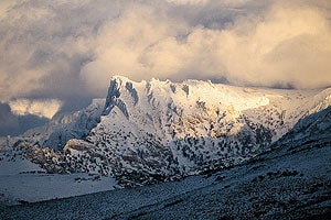
Welcome to Powder 101. First, some weather basics: Moist low-pressure systems from the Pacific, Atlantic and Gulf of Mexico provide the moisture for most snow enjoyed by skiers. Powder falls when these low-pressure systems collide with cold high-pressure systems. When a mountain gets in the way, the moisture rides up into the cold air and voilà -snow. Wind direction is also crucial, so learn which winds deliver snow to your hill. For example, a storm blown in from the West will hammer the west side of a mountain range while the east side gets skunked.
ADVERTISEMENT
For early indicators of storms that might bring the goods to your home hill, tune in to local weather reports and watch for large areas of precipitation off the coasts. That’s your cue to go online and monitor forecasts daily (see box). As to which types of weather patterns affect your region, here are the basics.
>Pacific Northwest
The Cascades get the biggest falls when low-pressure areas sweep down from the Gulf of Alaska toward California and Oregon. Generally, areas located in the northern half of the low-pressure area get the most snow. “You can get a phenomenal dump at Bachelor, and 150 miles south it’ll be all rain,” says Greg Thompson of the National Center for Atmospheric Research. If the center of the storm makes landfall in southern or central Oregon, it’s time to hit the road.
ADVERTISEMENT
>Rockies Colorado and Utah get big snows when areas of low pressure make landfall between San Francisco and Eugene, Ore. If the low is tracking from Eugene to Denver, head for Steamboat or Jackson Hole. Again, wind direction is key. Colorado’s eastern slope and Summit County are often hammered when easterly winds blow lows centered near Colorado Springs back up into the mountains. Montana and Idaho skiers want to look for lows that make landfall near Seattle or Vancouver.
>Northeast Nor’easters, where cold Canadian air collides with precipitation spinning up the coast, can bring powder to the Northeast, but not always. “Snowstorms are very fickle on the East Coast,” says Jim Cantore, host of the Weather Channel’s Storm Stories. Snow might pound the coast but miss the mountains, or warm southerly air will tag along, turning snow to slush. Look for storms that track just inland of the coast, pass near Philadelphia and head for Maine. If a Canadian high arrives at the same time, it’s payday. “Oftentimes the best scenario isn’t a Nor’easter but a weather pattern that brings three inches of snow a day for several days in a row,” says Hodanish, who went to college in Vermont. For these types of accumulations, look for a low that stalls over New Jersey or Southern New England. “If that low sticks around for a while, then you’re psyched.”
CAPTION BELOW
ADVERTISEMENT
PICTURING POWDER The folks from the National Atmospheric and Oceanographic Administration can be a skier’s best friends when it comes to predicting powder days. Here, from their website, are satellite images of a few days that Eastern skiers may well remember.
DECEMBER 2004