Updated August 20, 2025 07:08AM
Is It Too Early to Predict This Winter's Snowfall? This Forecast Doesn't Think So.
What does the snow cover in Siberia have to do with it? You'd be surprised.
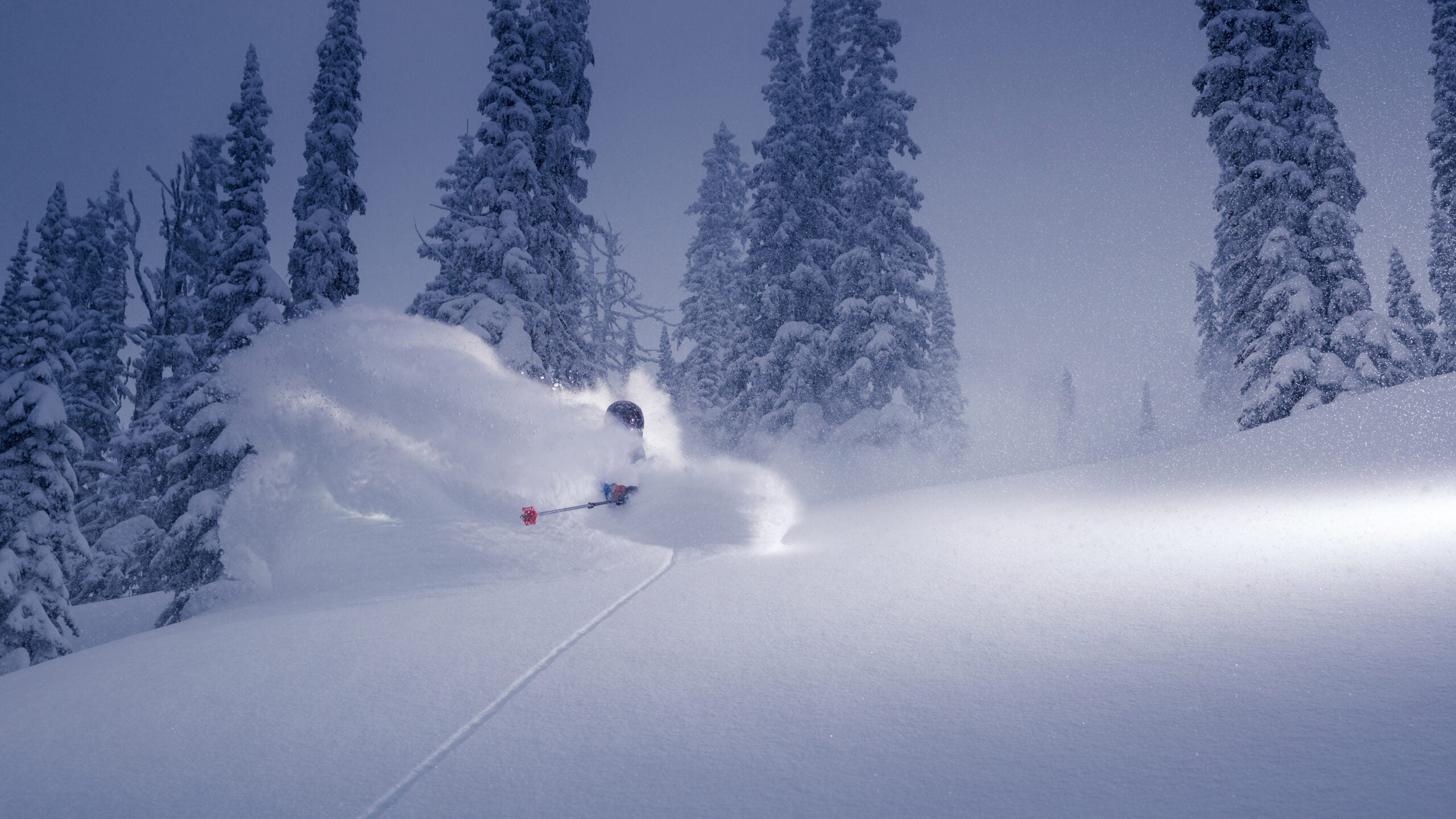
Heli skiing in deep powder. (Photo: Getty Images)
Every summer, the weather gurus weigh in on what kind of winter we might be looking at for the upcoming season. As skiers, we’re suckers for any type of talk about snow—especially during the dog days of summer. As skiers, we’re also naturally skeptical about long-range forecasts that are predicting the weather upwards of four–plus-months out.
That said, the guys over at Open Snow are the best meteorologists we know, let’s give them the benefit of the doubt. Open Snow’s Alan Smith shared some interesting stuff earlier this week that we’ll try to distill down below. They will share their full report on the 2025-’26 winter in August, but until then, it’s kinda fun to try to decipher the science-speak.
So, Where Will It Snow This Winter?
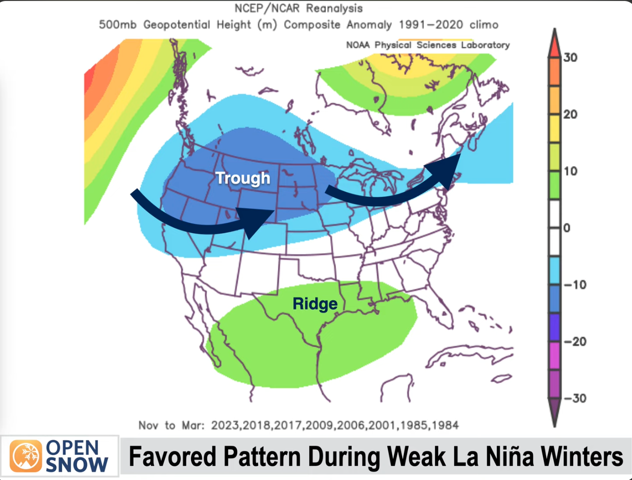
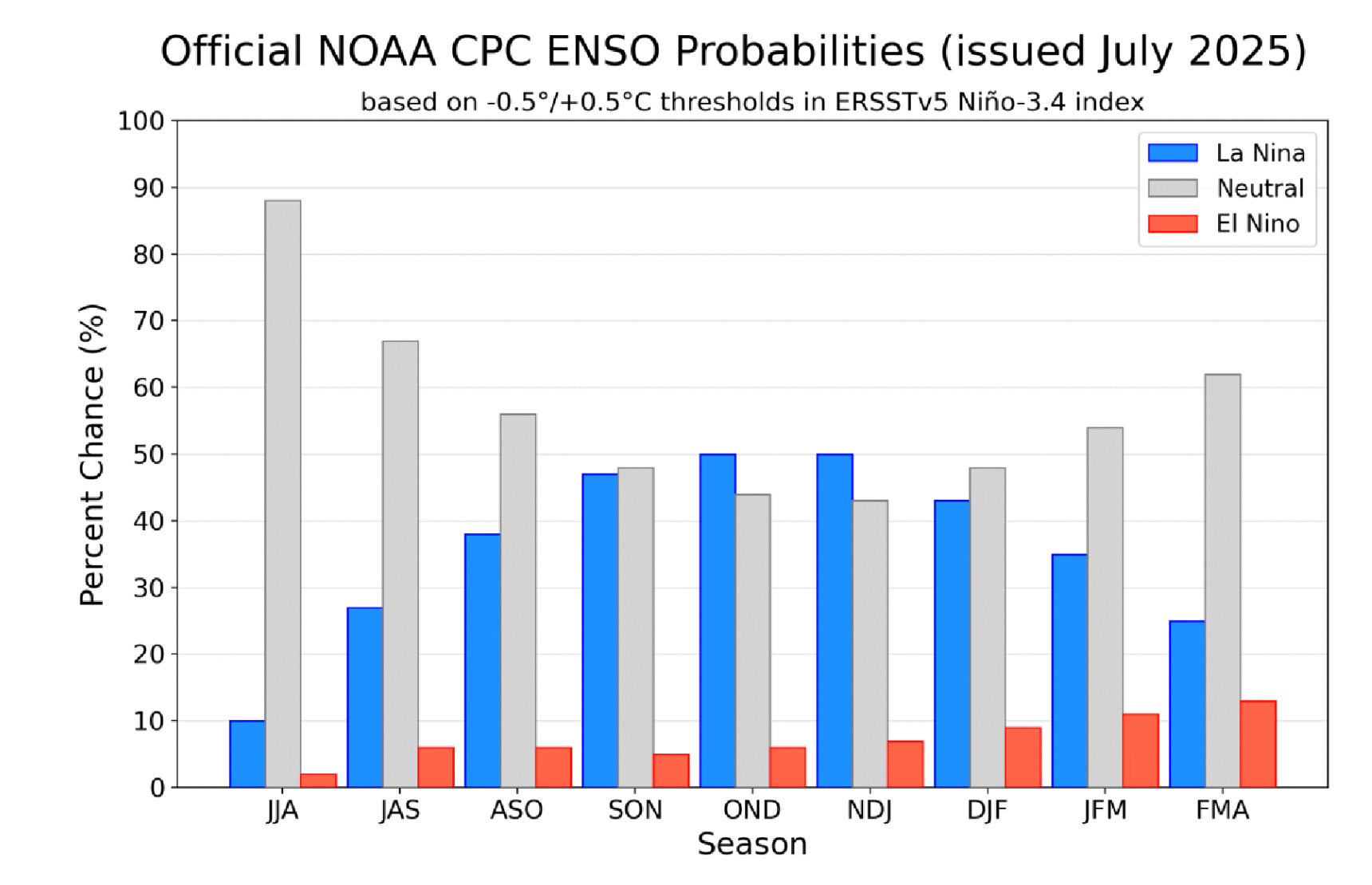
That’s the question on everyone’s mind, so we’ll get right to it. Open Snow predicts either a La Niña or a neutral winter, giving the La Niña a very slight advantage right now. There’s very little chance of an El Niño winter—less than 10 percent—according to Smith. For reference, last winter was considered a neutral/borderline La Niña season.
As for the coming winter, Smith explained in this seven-minute video that the main indication of an El Niño/La Niña pattern, the ENSO (El Niño Southern Oscillation), has been stalled in a neutral pattern this summer. But there are indications that a La Niña is emerging thanks to predicted cooler sea surface temperatures in the region of question—the eastern equatorial Pacific—this fall.
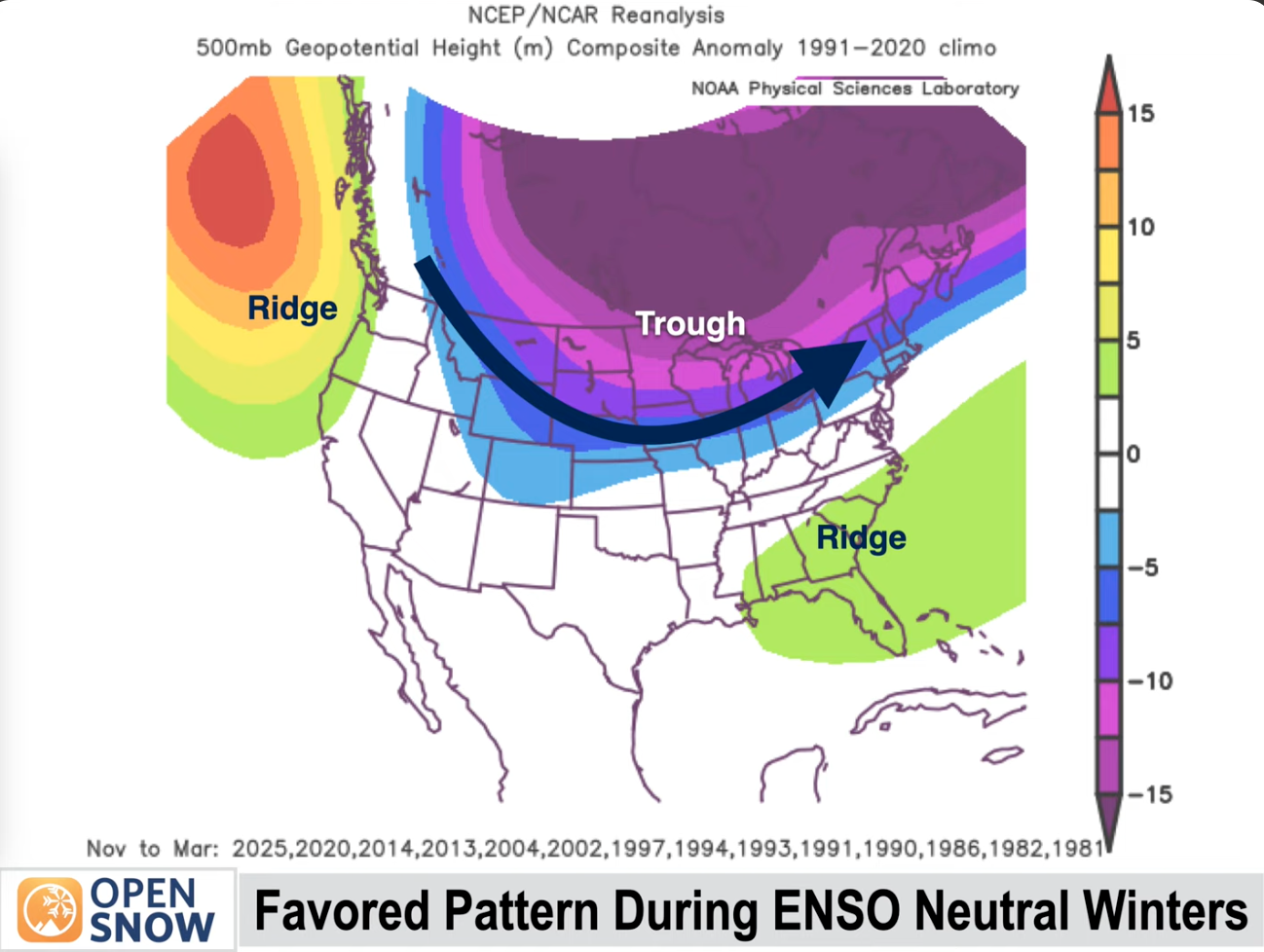
If we do get a La Niña, the regions that historically benefit with snowfall include the Sierra Nevada and the central Rocky Mountains, the Great Lakes, and New England. A neutral winter, on the other hand, favors the northern and eastern Rockies and northern New England, with drier weather on the West Coast.
ADVERTISEMENT
The Quasi-Biennial What?
Beyond that, there are a couple other interesting phenomena that meteorologists take into account in these long-range predictions. One of them is the surface temperatures of the North Atlantic ocean. Citing research from his colleague Luke Stone, who’s been studying the connection between sea temperatures in that region and North American snowfall patterns, Smith reports that the North Atlantic has been cooling down significantly after years of warming. Cooling surface temperatures = higher likelihood of La Niña.
Another factor they’re taking into consideration is called the Quasi-Biennial Oscillation, or the QBO, which is a measure of the upper level winds near the equator. It looks like the QBO next winter will lend itself to a high pressure trend, favoring a neutral winter.
If you’re still with me—and to be honest, I’m not sure I’m still with me—Smith reported a connection between the snow cover in Siberia and our winters here in North America. Citing research by Dr. Judah Cohen at MIT, he said that above-average snow cover can correlate to higher snowfall in the East and the Rockies, while lending itself to less snow on the West Coast. Who knew?
The bottom line: There will be snow. You might get some near you, or not. But if you like to geek out on long-range forecasts, your time to shine is now. Watch for Open Snow’s deep dive on the upcoming season, scheduled for next month.