Published May 6, 2010 06:29PM
Freeride Maps: Off-Piste and Backcountry Skiing in Switzerland and Austria
If you’re heading on a ski trip to Austria or Switzerland and you don’t want to spend the entire time carving groomers or getting lost on unmarked off-piste runs, pick up a new Freeride Map, which will show you where to find the steeps, powder, glaciers, and more.
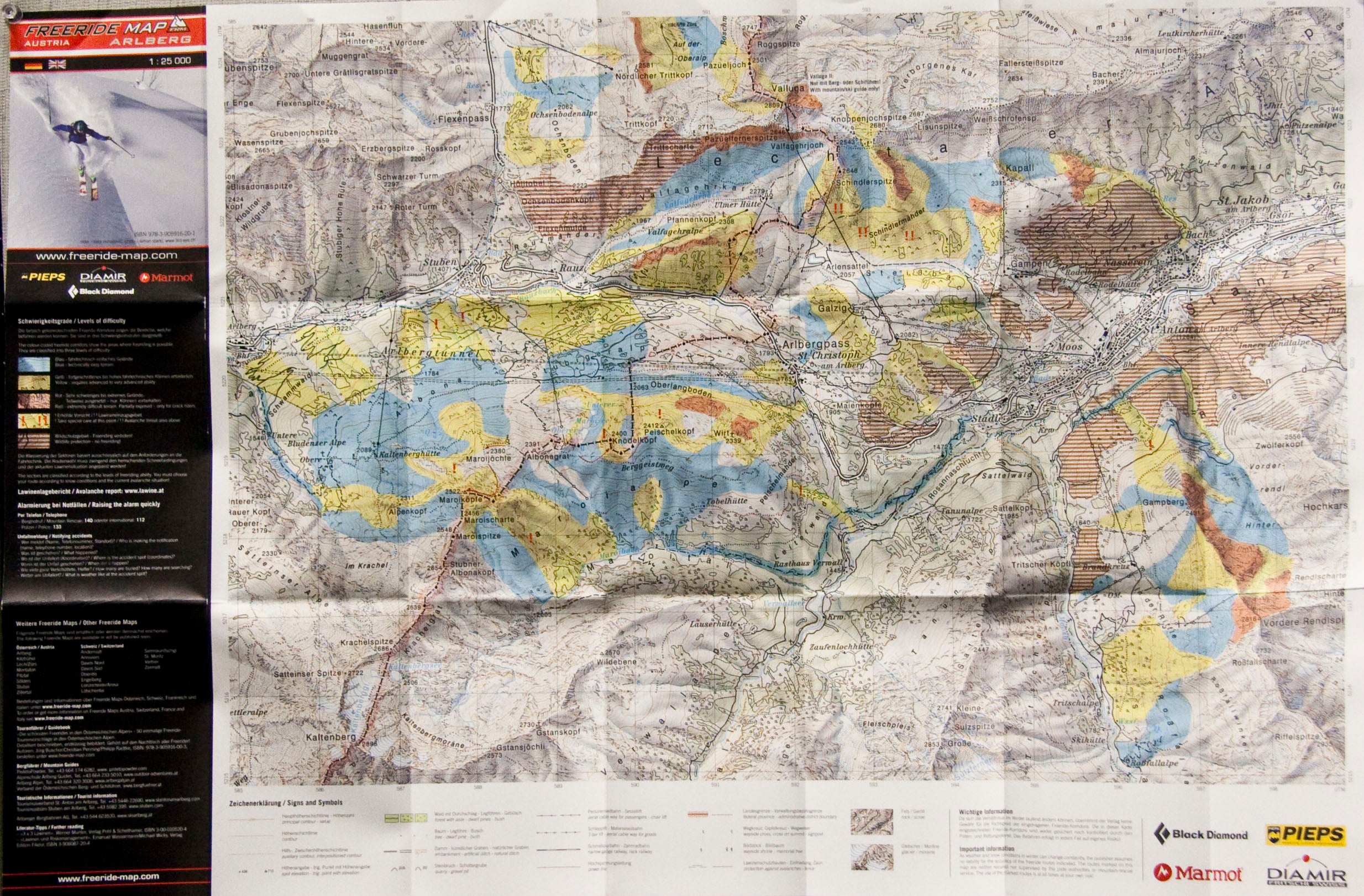
A group of Swiss freeskiers have put together Freeride Maps, detailed guides to skiing off-piste and backcountry terrain at some of Switzerland and Austria’s rowdiest resorts. Using official topography maps from the Swiss Federal Office of Topography and the Austrian Federal Office of Metrology and Surveying, the Freeride Maps show you the location of everything from aerial trams, to natural ditches and contours, to fences, railroad tracks, and power lines. The map, which is made from thick, waterproof material, is color coded to indicate easier, advanced, and extremely difficult terrain. It also marks severe avalanche threat areas, elevations, wildlife protection zones (where skiing isn’t allowed), and inclines.
You can buy them for resorts in Switzerland, including St. Moritz, Lötschental, Anniviers, Zermatt, Engelberg, Verbier, Disentis, Andermatt, and Davos. Each map costs about $25, or you can buy the whole Swiss package, which includes 12 maps for about $250. Austria maps include Arlberg and Ischgl/Samnaun. More Austria destinations will be available in October. Get them at www.freeride-map.com or ski shops and book stores in the Alps.